Case Study – Feature-based Plotting
Customer: Leading Cartography Company
Project: Feature-based plotting subsystem
Problem: Produce fully rendered feature-based plots on the desktop
Solution: Mill Creek Systems, Inc. developed a feature-based plotting system to render consumer and commercial maps such as road atlases, according to predefined feature information.
The solution Mill Creek Systems built provides feature symbolization and prioritization based on parameters in an external ASCII file derived from a master Oracle database.
Different map output styles (look & feel) easily achieved selecting a different ASCII files with different symbology parameters for each feature.
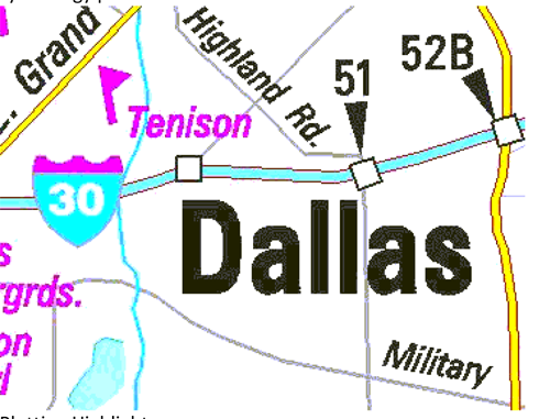
Plotting Highlights:
• Prioritization order based feature type (from linkages) and determined from external ASCII file
• Symbolization (color, weight, fill) for features determined from external ASCII file
• Masking is provided to achieve desired look for overlapping features (whited-out areas in interstate interchanges, toll booths)
• Linear Casing (plotting multiple times with different colors at different line weights) provided to enhance visual effect of primary linear features (interstate highways)Geographics
• Topology creation (area features) from discrete linear features powered by MicroStation